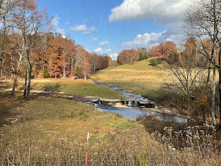
Old Stone Fort Bicycle Route Pictures
As we reach a destination I try to map out a road bike route. Luckily, the route sometimes provides some good views. Below are some pictures from my Old Stone Fort bicycle route. Some pictures, from TVA's Normandy Dam and the resulting Normandy Lake, are included although I added a detour from my normal route to take advantage of this photo opportunity. The detour only added 10 miles (~ 5 miles one way).
A little about the TVA (Tennessee Valley Authority): There are often/always campgrounds associated with the TVA dams. The TVA was created as part of a federal infrastructure bill, which is somewhat similar to the recently publicized infrastructure bill that passed. The TVA was created to provide flood control, recreational areas and energy production to Tennessee and downriver states such as AL. The TVA did not initially get created until the energy production component's contribution to War World II industrial support spurred congress to pass the legislation. The TVA is currently self funded due to the energy produced from hydroelectric power. One might easily conclude a successful example of the positive impact infrastructure bills can have.
I mentioned in my first post I will cover prior destinations. One destination was a campground at TVA's Douglass Dam. So stay tuned for that post.
Without further ado here are the Old Stone bicycle route pictures:
Start of Normandy Dam and Lake pictures as if that is not obvious.


Comments
Post a Comment